
Select 選擇
Activate the Select tool. 啓動選擇工具
 |
| Step1 要啟動[選擇]功能,必須先將圖層設定為編輯狀態。我們以[Poles]圖層為例,先點選[Poles],使其成為編輯狀態(紅框)。 |
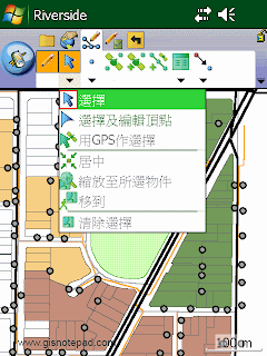 |
| Step2 點選[選擇] |
 |
| Step3 點選地圖右下角的1支電桿,被選取物件,會反藍顯示,表示選取中 |

Select And Vertex Editing 選擇及編輯頂點
Activate the Select And Vertex Editing tool. 啟動已選物件的頂點顯示及編輯

Select At GPS Position 用GPS作選擇
Select the feature at the current GPS position.在當前的GPS位置作選擇物件

Center On Selected Feature 居中所選物件
Center the map on the selected feature without changing the current map scale. 所選物件移動到視窗中央 但不改變現有地圖比例
 |
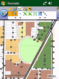
| Step1 點選[居中] |
 |
| Step2 原本右下角選取(反藍)的物件,移動到視窗中央 |

Zoom To Selected Feature 縮放至所選物件
Zoom to the selected feature. 縮放至所選物件範圍
 |
| Step1 點選[縮放至所選物件] |
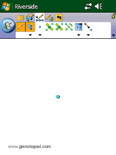 |
| Step2 原本右下角選取(反藍)的物件,移動到視窗中央並放大 |

Go To Selected Feature 移至所選物件位置
Activate line-of-sight or ArcLogistics navigation. 設定己選物件為現時導航的目的地

Clear Selected 清除選擇
Feature Unselect the selected feature. 放棄已選物件
 |
| Step1 點選[清除選擇] |
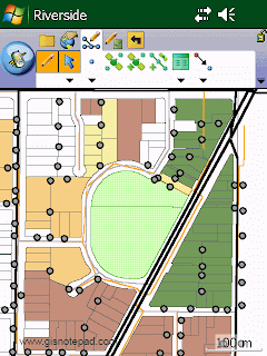 |
| Step2 原右下角反藍被選取物件,取消選取 |
Reference to ESRI® ArcPad® 10 Quick Reference