 Identify 識別
Activate the Identify tool. 啓動識別工具
Identify 識別
Activate the Identify tool. 啓動識別工具

Measure
量度
Measure distances in the map view in point mode.
測量直線距離
 |
| Step1 點選[量度] |
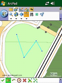 |
| Step2 在地圖上用觸控筆點畫折線(polyline),按[繼續獲取屬性]。 |
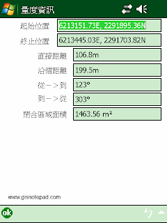 |
| Step3 顯示剛才畫的折線起始與終止位置、距離和面積。 |
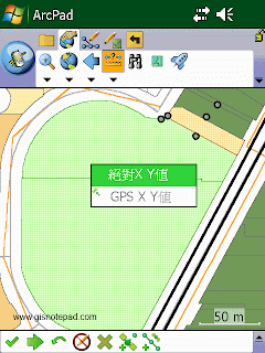 |
除了直接在地圖上畫線,也可以直接輸入坐標或抓取GPS的坐標。
例如:點選[絕對XY值] |
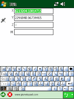 |
| 顯示頂點對話框,直接輸入XY值,按[OK]便可。 |

Radial Measure
半徑量度
Measure radial distances in the map view using the stylus. 測
量半徑距離
 |
| Step1 點選[半徑量度] |
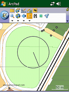 |
| Step2 直接在地圖上畫圓 |
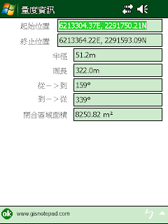 |
| Step3 顯示圓的中心點和終點坐標、半徑、周長、面積等 |

Freehand Measure
徒手量度
Measure distances in the map view in freehand mode.
徒手畫線測量地圖距離
 |
| Step1 點選[徒手量度] |
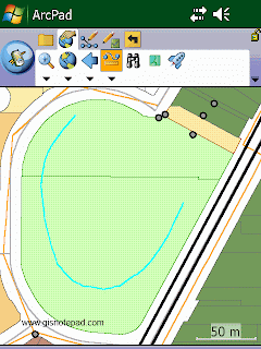 |
| Step2 直接在地圖上畫任意線段 |
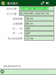 |
| Step3 顯示線段起始與終止位置、距離和面積 |

Hyperlink
超連結
Activate the Hyperlink tool.
啓動超連結工具

Go To
移到
Activate line-of-sight or ArcLogistics™ navigation.
啓動視線或ArcLogistics導航

Label
標籤
Activate the Label tool.
啓動標籤工具

Advanced Select
進階選擇
Activate the Advanced Select tool.
啓動進階選擇工具
Reference to ESRI® ArcPad® 10 Quick Reference
