 Options 選項
Open the ArcPad Options dialog box. 開啓ArcPad選項對話盒
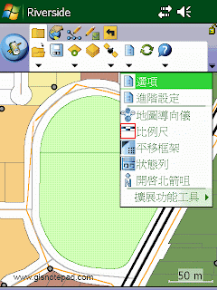 |
| Step1 點選[選項] |
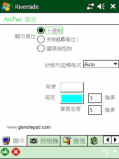 |
| Step2 出現[ArcPad選項]對話框,含顯示、照相機、路徑、一般、導航、ArcIMS、區域、字體等設定分頁 |
 Advanced Settings 進階設定
Open the Advanced Settings dialog box. 開啓ArcPad進階設定對話盒
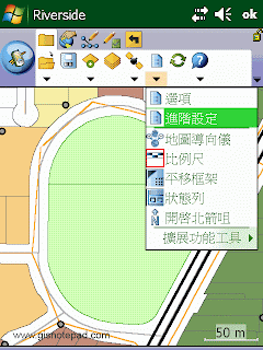 |
| Step1 點選[進階設定] |
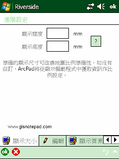 |
| Step2 顯示[進階設定]對話框,含顯示大小、編輯、顯示質素、輔助設備端口、腳本、擴展功能等分頁 |
 Map Navigator 地圖導向儀
Display or hide the map navigator. 顯示或隱藏地圖導航儀
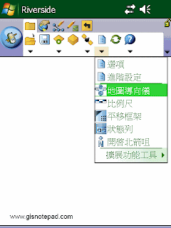 |
| Step1 點選[地圖導向儀] |
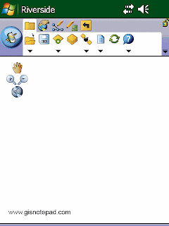 |
| Step2 地圖左上角顯示導航儀,可平移、放大縮小和縮放全景 |
 Scale Bar 比例尺
Display or hide the scale bar. 顯示或隱藏比例尺
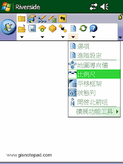 |
| Step1 點選[比例尺] |
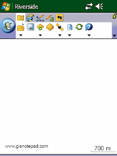 |
| Step2 地圖右下角顯示比例尺 |
 Panning Frame 平移框架
Display or hide the map panning frame. 顯示或隱藏地圖平移框架
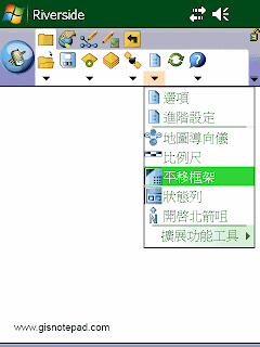 |
| Step1 點選[平移框架] |
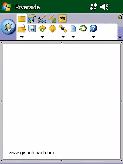 |
| Step2 地圖四週出現平移框架,地圖可依點選方向的邊框移動 |
 Status Bar 狀態列
Display or hide the status bar. 顯示或隱藏狀態列
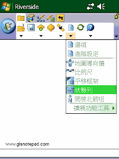 |
| Step1 點選[狀態列] |
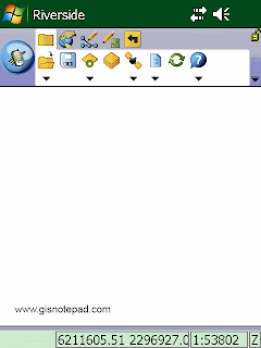 |
| Step2 地圖下方出現狀態列,顯示坐標和比例尺 |
 North Arrow 指北針
Display or hide the north arrow in the map view. 在地圖畫面中顯示或隱藏指北針
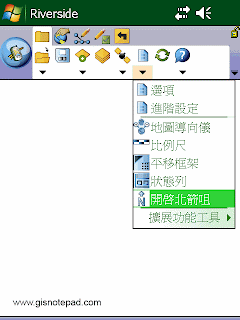 |
| Step1 點選[開啟指北針] |
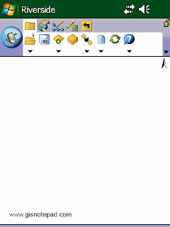 |
| Step2 地圖右上角顯示指北針,以地圖上方為正北 |
 Extension Tools 擴充功能工具
Open the Preferences dialog box for the loaded extension. 開啟已載入的擴充功能喜好對話盒
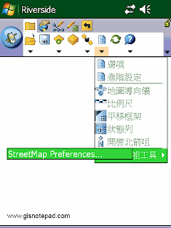
Reference to ESRI® ArcPad® 10 Quick Reference